Atmos UAV Introduces the Sony a6100 Oblique to Provide Accurate and Affordable 3D Mapping
Atmos UAV Introduces the Sony a6100 Oblique to Provide Accurate and Affordable 3D Mapping
Atmos UAV Introduces the Sony a6100 Oblique to Provide Accurate and Affordable 3D Mapping
Atmos UAV Introduces the Sony a6100 Oblique to Provide Accurate and Affordable 3D Mapping
Valkenburg
Wednesday, August 9, 2024
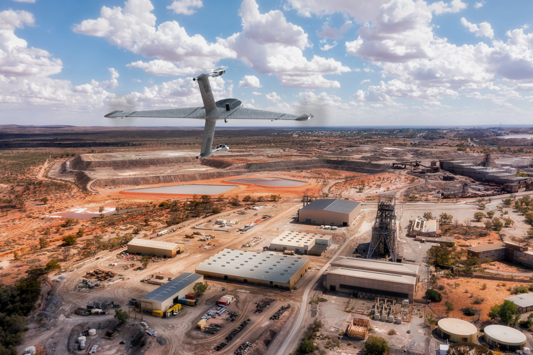
Atmos UAV, a leading innovator in the VTOL mapping drone industry, is excited to announce the integration of the new Sony a6100 Oblique camera into its flagship surveying drone, the Marlyn Cobalt
What’s a Rich Text element?
The rich text element allows you to create and format headings, paragraphs, blockquotes, images, and video all in one place instead of having to add and format them individually. Just double-click and easily create content.
Test
Static and dynamic content editing
A rich text element can be used with static or dynamic content. For static content, just drop it into any page and begin editing. For dynamic content, add a rich text field to any collection and then connect a rich text element to that field in the settings panel. Voila!
How to customize formatting for each rich text
Headings, paragraphs, blockquotes, figures, images, and figure captions can all be styled after a class is added to the rich text element using the "When inside of" nested selector system.
test
H1
H2
H3
H4
H5
Headings, paragraphs, blockquotes, figures, images, and figure captions can all be styled after a class is added to the rich text element using the "When inside of" nested selector system.
Atmos UAV, a leading innovator in the VTOL mapping drone industry, is excited to announce the integration of the new Sony a6100 Oblique camera into its flagship surveying drone, the Marlyn Cobalt. This strategic partnership with Sony further solidifies Atmos UAV's commitment to providing state-of-the-art solutions to professionals in the geospatial mapping and surveying sectors.
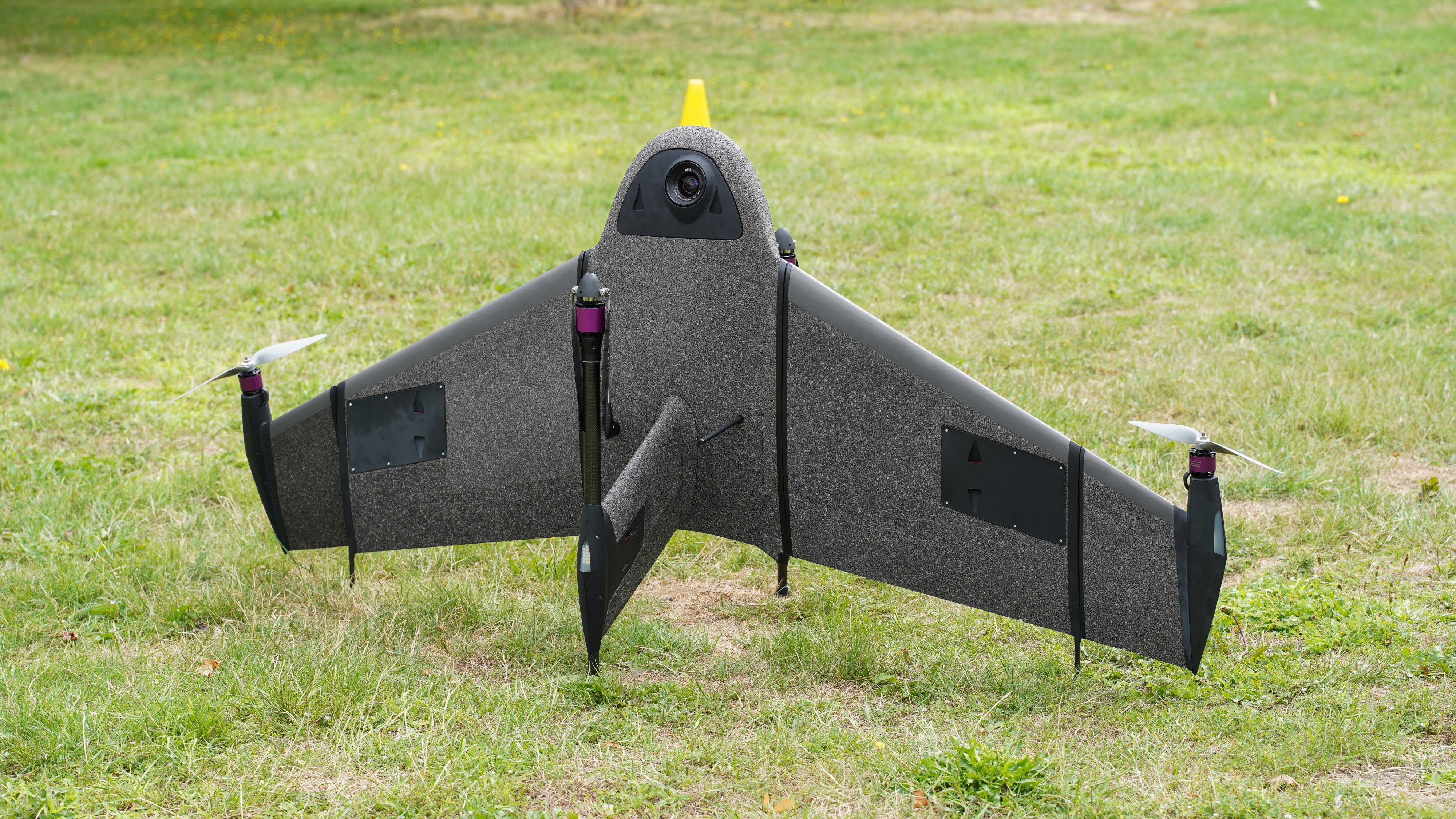
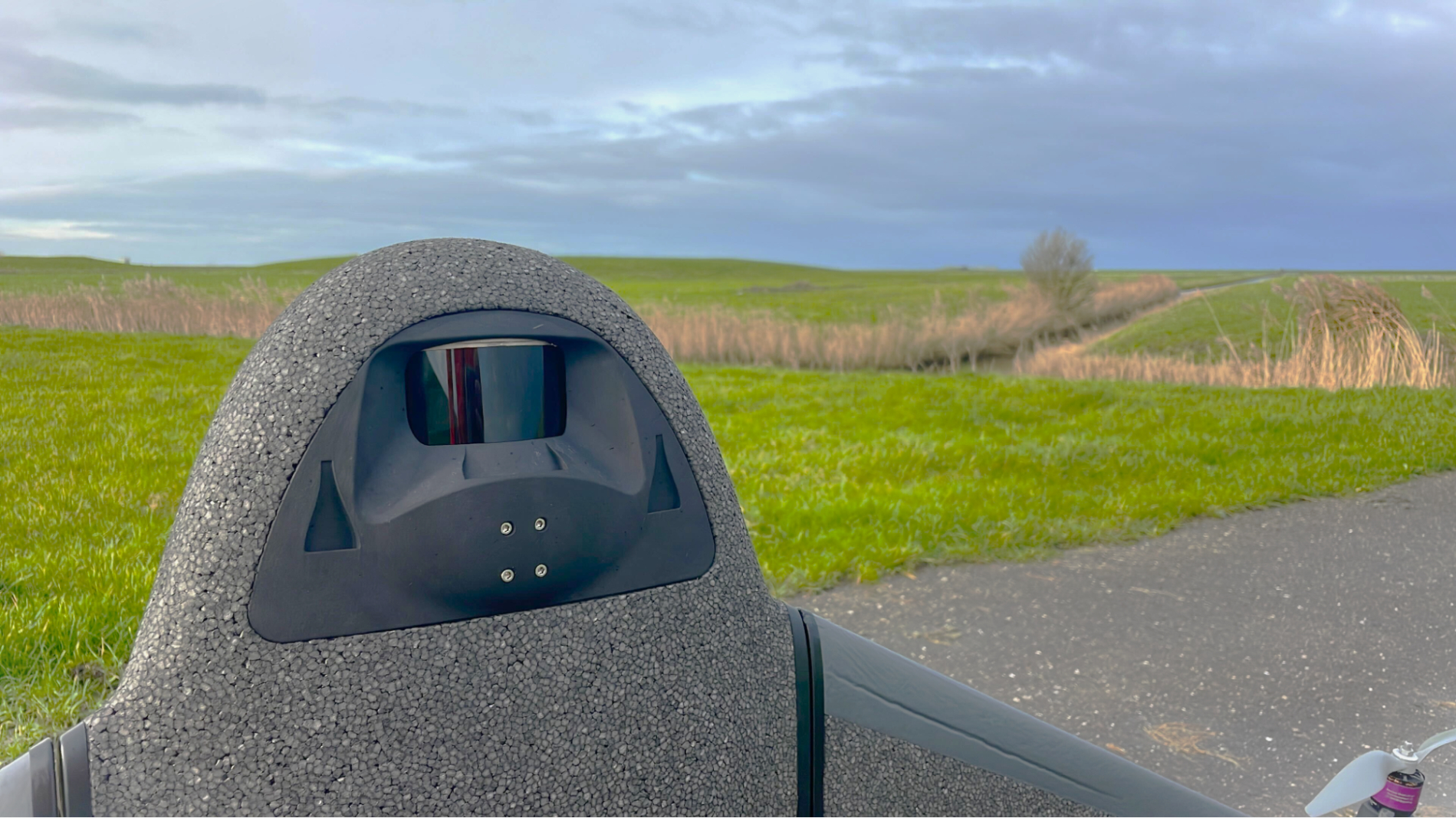
The Sony a6100 Oblique camera is a revolutionary addition to the Marlyn Cobalt, which combines Sony's 24MP a6100 with a Meike 12mm lens, providing an excellent solution for cost-effective, lower-resolution surveying and produces fantastic 3D models for urban surveys.
Marlyn Cobalt equipped with Sony a6100
Competitive Pricing
One of the primary advantages of the Sony a6100 Oblique integration is its competitive pricing. As the entry-level cousin to the workhorse a7RIV 61MP camera, the a6100 comes in at a 20% lower price point, whilst still managing a respectable 4cm [1.5in] GSD at 400 feet. This allows professionals to access high-quality imagery without breaking the bank.
Unmatched Oblique Information for Urban 3D Mapping
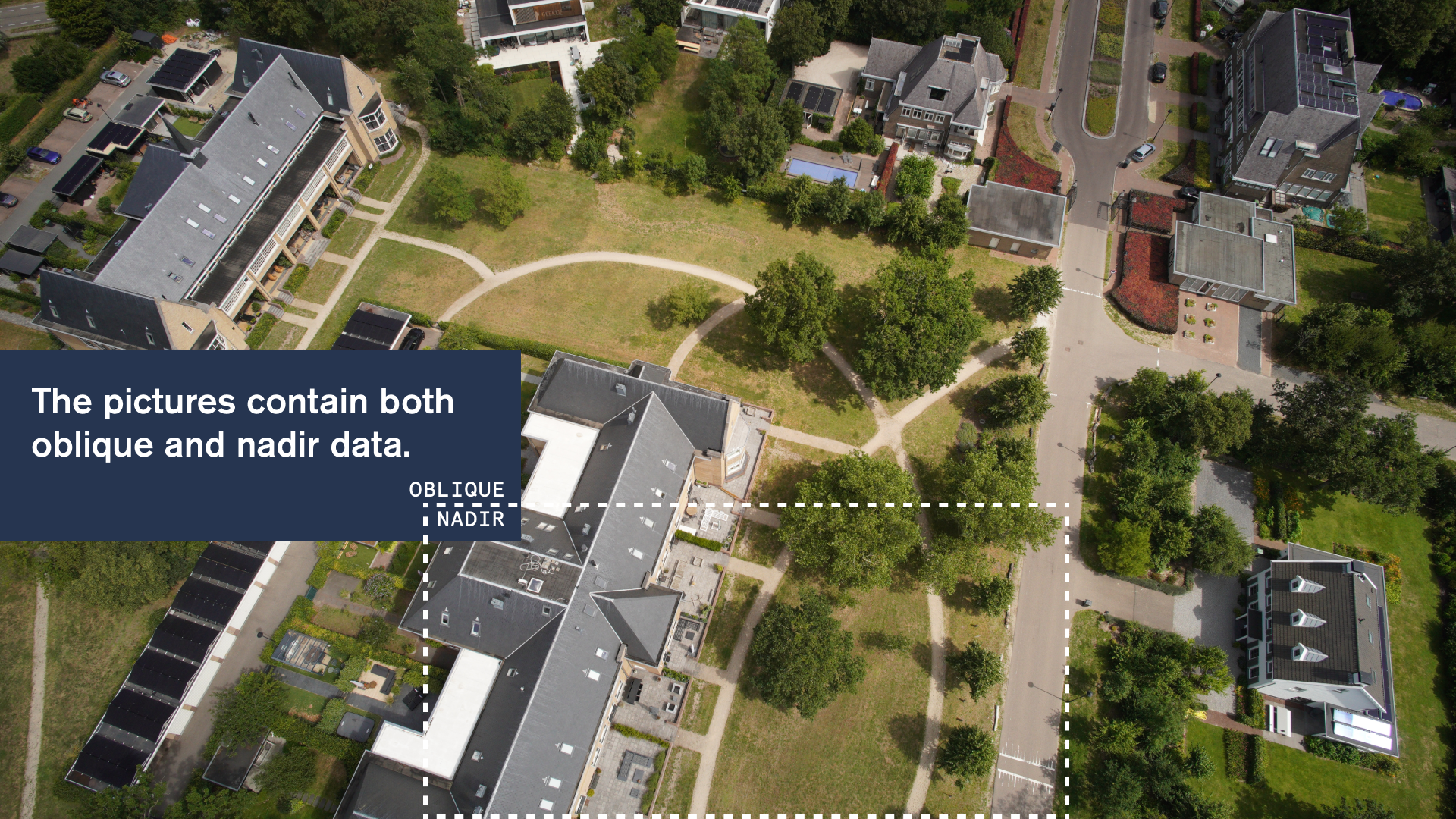
The 12mm wide angle lens, and fixed angled mounting empowers the a6100 Oblique to capture a high quality of data on vertical surfaces, allowing for a comprehensive view of urban environments during 3D mapping missions. This feature significantly enhances data collection efficiency and improves the accuracy of 3D models, giving surveyors and urban planners unparalleled insights for their projects.
Oblique and Nadir data with Sony a6100
Expanded Coverage with Exceptional Resolution
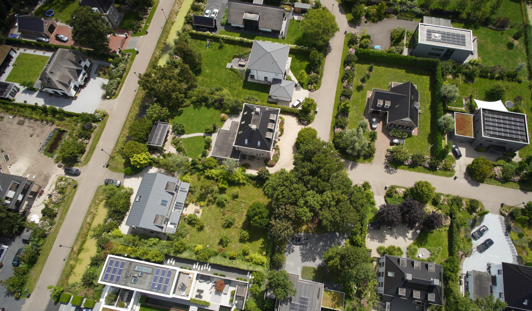
With the integration of the 'Sony a6100 Oblique' camera, the 'Marlyn Cobalt' now boasts an impressive 350-hectare coverage at 400 feet. This means that surveyors can efficiently cover vast areas in a single flight, reducing operational time and costs. The resulting ground sampling distance (GSD) of 4cm at that altitude ensures high-resolution data acquisition, delivering sharp and detailed images for precise analysis.
Image captured by Marlyn Cobalt equipped with Sony a6100 (reduced size)
Sancta Maria A6100 Dataset
Download the Images and Geotags, Orthophoto, and Point Cloud
Download Dataset
See it in Action
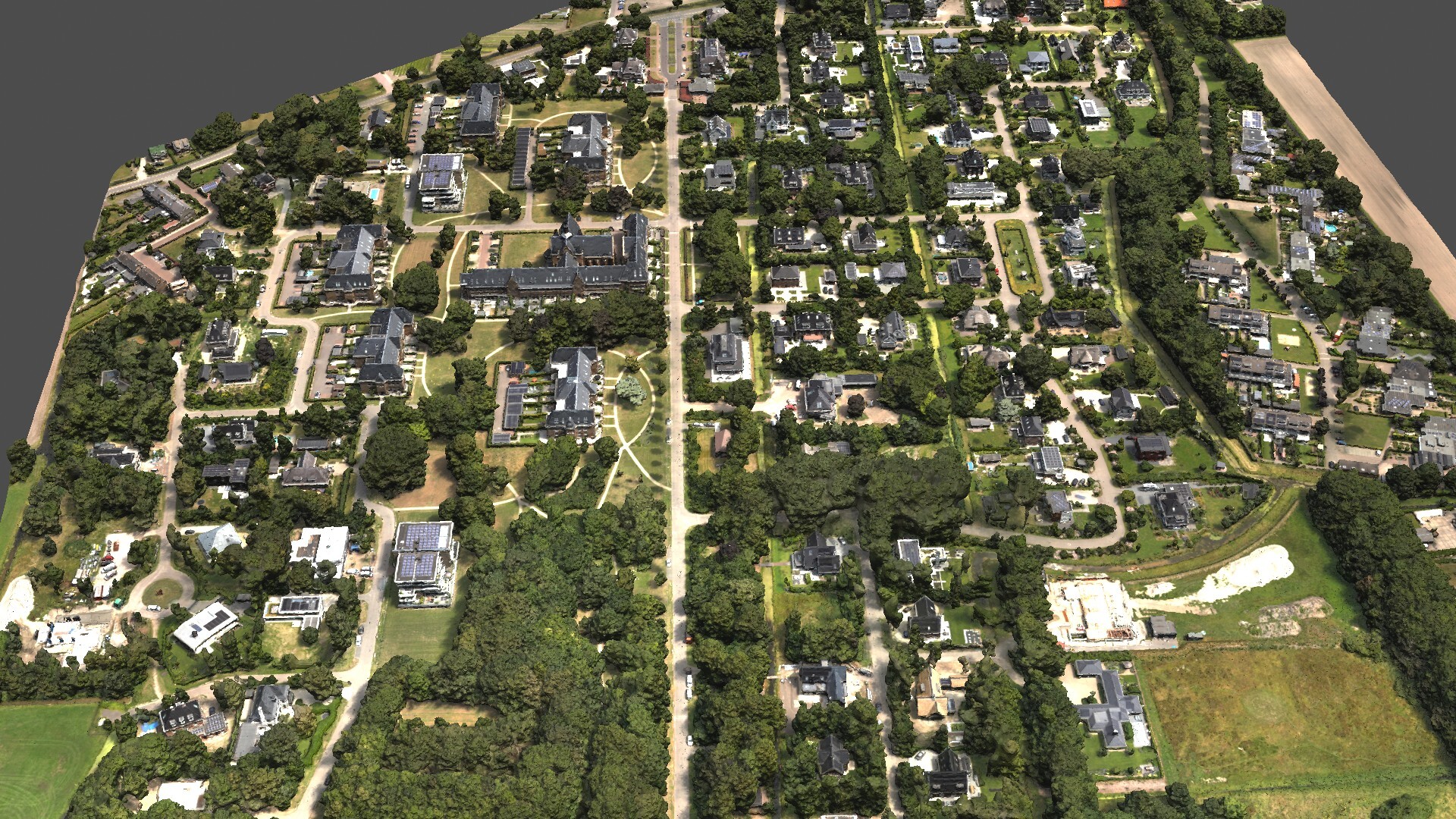
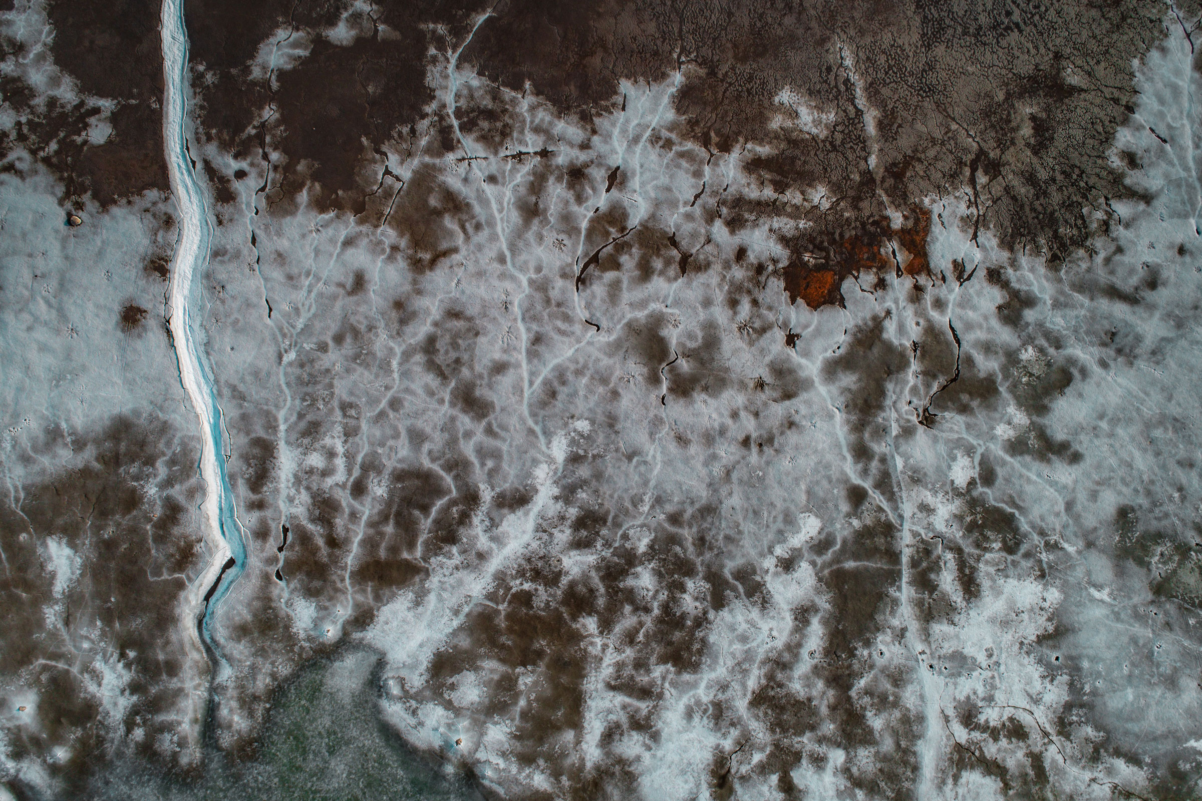
To showcase the outstanding quality of the urban mapping capabilities, including the 3D information that can be gleaned from vertical surfaces, we invite you to explore the dataset below. This map was surveyed by one of Atmos’ customers, enabling them to identify and inspect the built and natural environment (houses, treetops, etc.) through different processing ways in the town of Sancta Maria in the Netherlands for urban planning purposes.
A sneak preview of the finished render you can see below.
3D reconstruction of the Sancta Maria urban area
No items found.
About
Atmos
Founded in 2013, Atmos is a Dutch scale-up based in Leiden, specialised in the design and production of high-end aerial surveying and data collection drones that enable professionals to effortlessly gather geospatial data from the sky, enabling them to make more informed decisions. The flagship drone model Marlyn has a world wide unique design that combines the high performance of a conventional fixed-wing aircraft with the flexibility of helicopters. With their patented technology the company targets mapping, construction, mining, agriculture, environmental and related applications. To facilitate the fast growth of the company, Atmos UAV is currently attracting new talent to expand the team and scale-up the production.