Construction surveying. Marlyn provides data for a major overhaul of an industrial site
Construction surveying. Marlyn provides data for a major overhaul of an industrial site
Construction surveying. Marlyn provides data for a major overhaul of an industrial site
Construction surveying. Marlyn provides data for a major overhaul of an industrial site
Delft
Tuesday, December 18, 2024
Every construction site comes with its own challenges when it comes to planning, documentation, and monitoring.
What’s a Rich Text element?
The rich text element allows you to create and format headings, paragraphs, blockquotes, images, and video all in one place instead of having to add and format them individually. Just double-click and easily create content.
Test
Static and dynamic content editing
A rich text element can be used with static or dynamic content. For static content, just drop it into any page and begin editing. For dynamic content, add a rich text field to any collection and then connect a rich text element to that field in the settings panel. Voila!
How to customize formatting for each rich text
Headings, paragraphs, blockquotes, figures, images, and figure captions can all be styled after a class is added to the rich text element using the "When inside of" nested selector system.
test
H1
H2
H3
H4
H5
Headings, paragraphs, blockquotes, figures, images, and figure captions can all be styled after a class is added to the rich text element using the "When inside of" nested selector system.
Every construction site comes with its own challenges when it comes to planning, documentation, and monitoring. All these challenges can now be addressed with the use of drones, which not only provide safer operations for both people and equipment, but do so with high cost effectiveness.
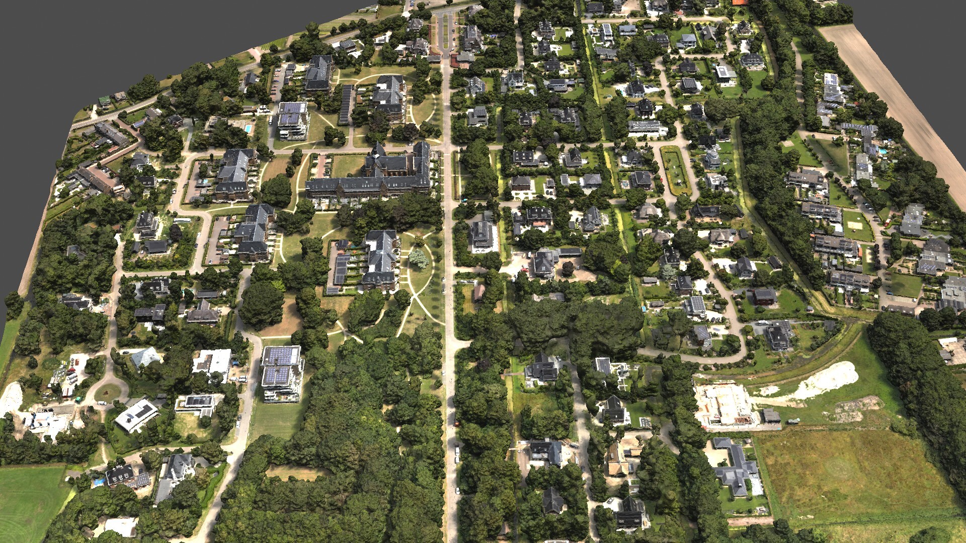
For this project, an accurate visualization of the whole area with high resolution was needed for a complete overhaul of an industrial area in the Netherlands. The owners wanted to inspect the roofs (for damages and solar installations), perform volumetric analysis for a pile of sand that needed to be removed, and have an overview of roads and buildings’ facades.
The use of drone surveying in this type of projects not only provides great time savings in terms of operations, but also ensures the safety of surveyors (since no staff is needed to manually inspect the roofs).
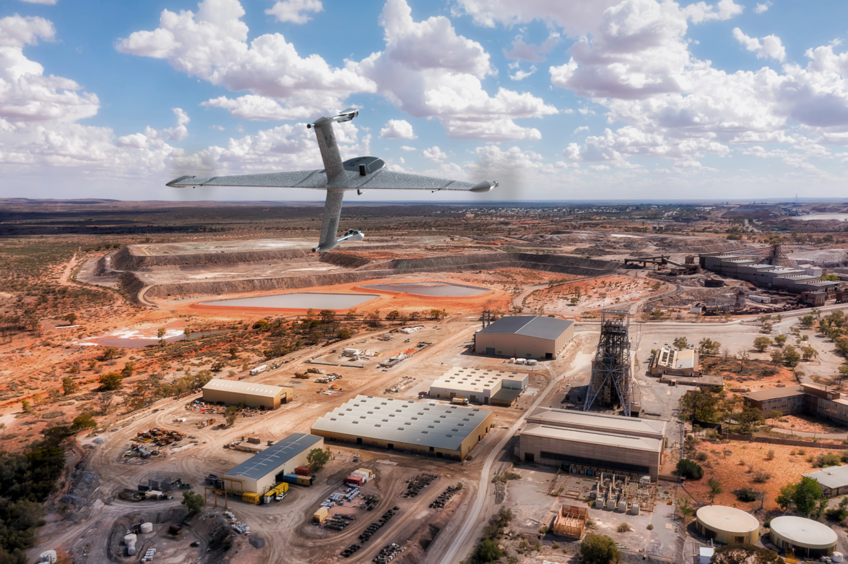
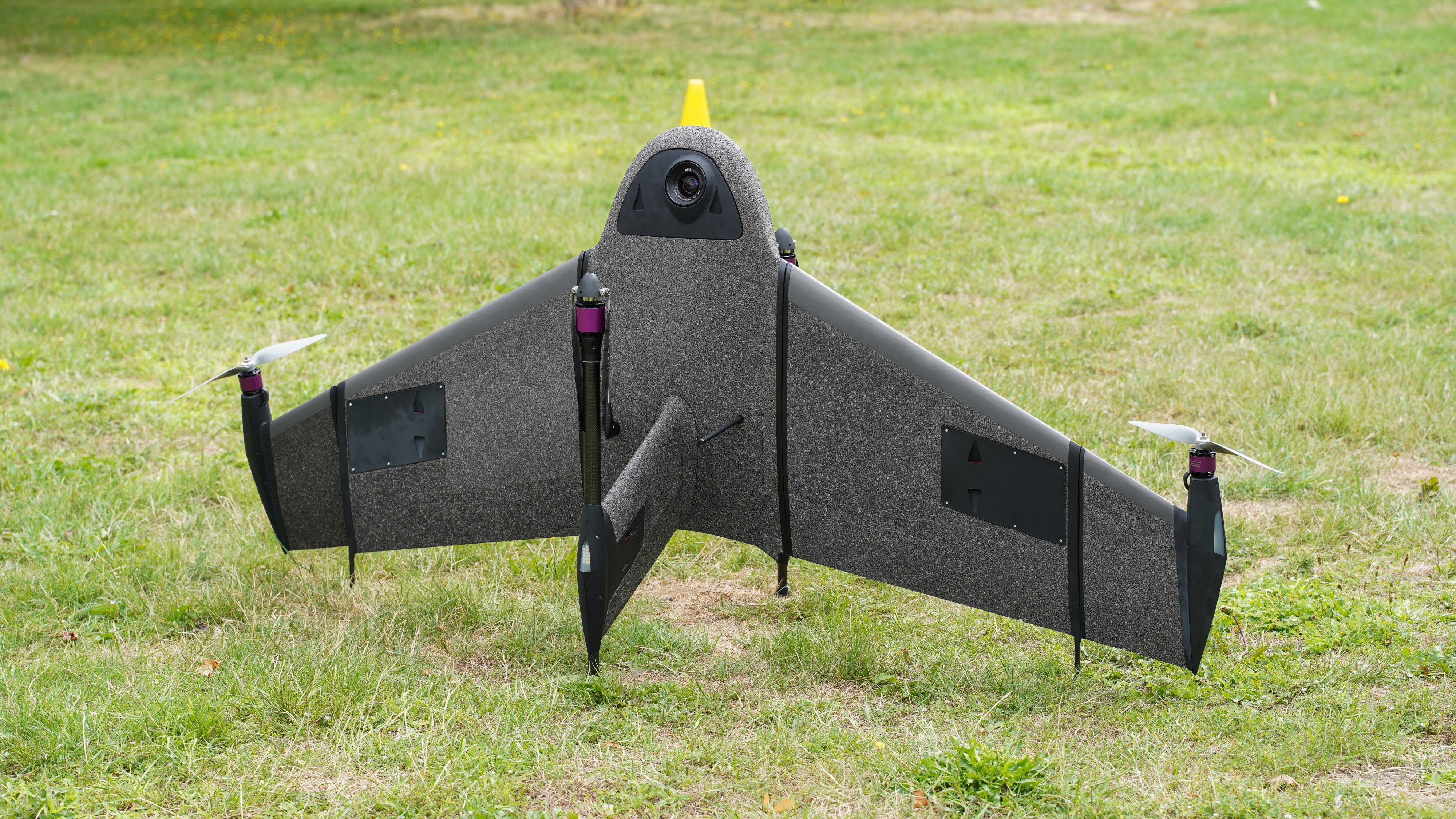
To that end, Marlyn, equipped with a 20MP SONY UMC-R10C, performed a single 15-minute flight at 115m and captured 241 images with a GSD of 2.5 cm to produce a 3D model of the area.
The detailed outputs produced by Marlyn's captured data provided vast information for the site, that will drastically improve the planning and budgeting of the overhaul. Watch the video below of the generated 3D model.